
Tidal landscapes, woodland and riverside walks
Martlesham Creek is a sheltered tidal inlet of the River Deben, situated between Martlesham and Woodbridge in east Suffolk. Within the Suffolk & Essex Coast & Heaths National Landscape, the creek forms part of a varied landscape of saltmarshes, tidal mudflats, grazing marshes, woodland and gently rising farmland.
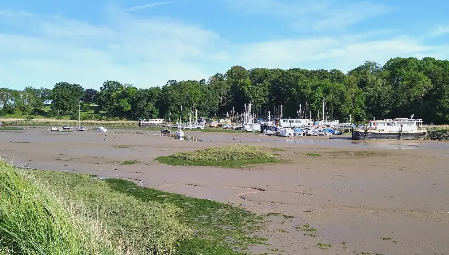
The creek extends inland from the Deben Estuary at Kyson Point, narrowing towards Martlesham, where the River Fynn meets the tidal waters. Its appearance changes considerably throughout the day, with muddy channels and exposed saltmarshes at low tide giving way to broad stretches of sheltered water as the tide rises.
One of the most popular ways to explore Martlesham Creek is on foot from Woodbridge. Riverside paths lead south from the town's historic waterfront towards Kyson Hill and Kyson Point, passing sailing boats, wooded riverbanks and open stretches of the Deben before following the edge of the creek.
Managed by the National Trust, Kyson Hill offers elevated views across the Deben Estuary and the surrounding countryside. Its grassy slopes and woodland provide a contrast to the low-lying marshes below, making it a particularly attractive place to stop and appreciate the wider landscape.
On the southern side of the creek, Martlesham Wilds Nature Reserve, managed by Suffolk Wildlife Trust, is an extensive landscape where former farmland is being restored for nature. Grazing marshes, hedgerows, woodland, ponds and areas of saltmarsh form an increasingly diverse network of habitats, supporting wildlife and contributing to the ecological recovery of the Deben Estuary.
Martlesham Creek is particularly rewarding for birdwatching. Redshanks, curlews, little egrets, shelducks and other estuary birds can be seen feeding along the exposed mudflats, while the surrounding woodland and hedgerows provide habitats for smaller birds, insects and mammals. The changing seasons and tidal conditions bring considerable variety to the landscape throughout the year.
The King Charles III England Coast Path, Sandlings Walk and Fynn Valley Walk connect Martlesham Creek with the surrounding Suffolk countryside and the River Deben. Shorter circular walks from Woodbridge can combine the creek with Kyson Hill, Broom Heath and quiet woodland paths. Some low-lying sections can become submerged at high tide, so walkers should check tidal conditions before setting out.
The surrounding area offers further opportunities to explore the River Deben, from the historic waterfront and Woodbridge Tide Mill to the Anglo-Saxon burial grounds at Sutton Hoo. Further downstream, the riverside settlements of Waldringfield, Bawdsey and Felixstowe Ferry offer different perspectives on the estuary and its maritime heritage.
For visitors exploring Martlesham Creek, The Station Guest House offers accommodation beside the railway station, close to the historic waterfront of Woodbridge. Its location provides convenient access to the River Deben, the Sandlings Walk and the riverside paths leading towards Martlesham Creek, making it a well-placed base for discovering the surrounding countryside on foot.
Overview
Type: Tidal Creek
County: Suffolk
Region: East of England
National Landscape: Suffolk & Essex Coast & Heaths National Landscape
Landscape: Tidal creek, saltmarshes, mudflats, grazing marshes, woodland and estuary habitats
Key Trails: King Charles III England Coast Path, Sandlings Walk, Fynn Valley Walk
Best For: Riverside walking, birdwatching, woodland walks, wildlife and estuary views
Featured Stay

The Station Guest House, Woodbridge
Stay at The Station Guest House in Woodbridge, a family-run guest house occupying the former stationmaster's house, with three en-suite guest rooms overlooking the River Deben and breakfast available at the adjoining Whistle Stop Café, close to Woodbridge Tide Mill and the town's historic waterfront.
Check availability
Select your dates to check current availability and prices.


