Fossil cliffs, sweeping beaches, and the long curve of the Jurassic Coast
From Exmouth to Poole Harbour in Dorset, the South West Coast Path follows the Jurassic Coast as a long-distance self-guided travel route linking walking routes, landscapes, and places. The shoreline is shaped by stone and tide, with cliffs, beaches, and chalk headlands revealing layers of geology stretching back millions of years.
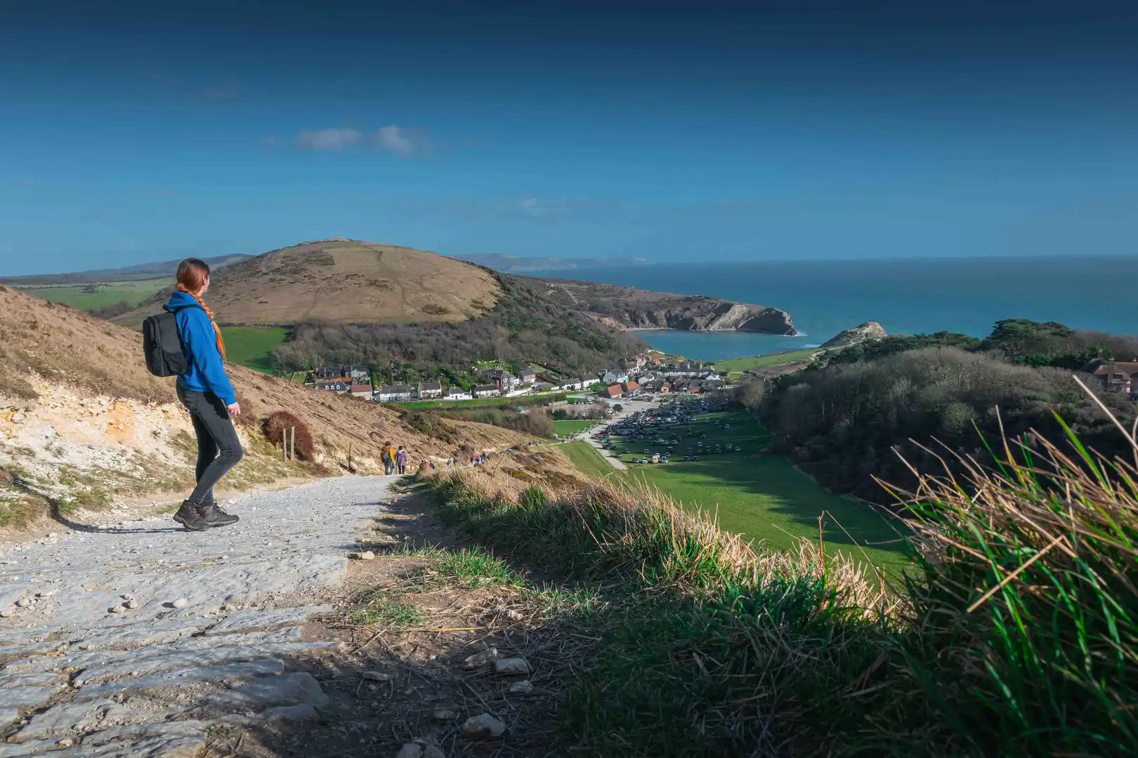
Much of the route rises and falls steadily across open ground. Chalk ridges and grassy slopes give way to long beaches and shingle bars before climbing again onto exposed headlands. Progress follows the shape of the coast, curving inland around bays and out again toward the sea.
Cliffs dominate long stretches of the walk. Bands of limestone, clay, and sandstone stand exposed, their surfaces marked by erosion and movement. Wide sweeps of shore appear between them, from the arc of Chesil Beach to smaller coves tucked beneath the downs. Rock formations such as Durdle Door and Old Harry Rocks sit clearly on the skyline, visible long before the path reaches them.
Towns and harbours gather at intervals along the coast. Lyme Regis, Weymouth, and Swanage cluster around their quays and beaches, their promenades and waterfront paths forming part of the day’s progress. Settlements appear naturally between open sections, offering pauses without breaking the continuity of the walk.
Stone, tide, and long views shape this coastline, where the path traces the edge of land and the long history written into the cliffs.
Trail Overview
Distance
Approx. 95 miles / 152 km
Typical time on foot
7–10 days
Start
Exmouth, Devon
Finish
Poole Harbour, Dorset
Terrain
Clifftop paths, chalk downs, pebble beaches, harbour towns, and coastal farmland
Waymarking
National Trail acorn symbols throughout
