
Walk the King Charles III England Coast Path: North East
The North East section of the King Charles III England Coast Path follows the eastern coastline of England from the Humber Bridge near Hessle to the Scottish border north of Berwick-upon-Tweed. Part of England's longest National Trail, the route crosses the coastal landscapes of East Yorkshire, North Yorkshire, County Durham, Tyne and Wear and Northumberland, connecting estuaries, sandy beaches, chalk cliffs, fishing villages, seaside towns and historic coastal landmarks.
Beginning at the Humber Bridge, the trail follows the northern shore of the Humber Estuary through Hull and eastwards towards Easington. The landscape changes from docks and waterfront settlements to the open mudflats, grazing land and tidal environments of the Holderness coast. Near the mouth of the Humber, Spurn Point forms one of the region's most distinctive coastal landscapes, with its narrow spit, shifting sands and important bird habitats.
From Easington, the route continues north along the Holderness coast, passing coastal villages and the rapidly eroding cliffs of East Yorkshire before reaching Bridlington. Beyond the town, the coastline rises into the chalk headlands of Flamborough Head, where steep white cliffs, sea caves and seabird colonies create a dramatic change in scenery. The nearby Bempton Cliffs nature reserve is particularly well known for its breeding seabirds.
The trail continues towards Filey, where it connects with the Yorkshire Wolds Way and follows sections shared with the Cleveland Way. From Filey, the route passes Scarborough and follows the rugged North Yorkshire coastline through Robin Hood's Bay and Whitby. Much of this section lies within the North York Moors National Park, where high cliffs, coastal grassland, wooded valleys and historic fishing settlements shape the landscape.
North of Whitby, the trail continues through Sandsend, Runswick Bay and Staithes towards Saltburn-by-the-Sea. The coastline gradually becomes more industrial around Redcar, the Tees Estuary and Middlesbrough, where ports, tidal habitats and waterfront communities form part of the changing character of the coast.
Beyond the River Tees, the route passes Hartlepool and continues through the Durham Heritage Coast. Former colliery landscapes have been transformed into coastal grassland and walking routes, with limestone cliffs, beaches and nature reserves around Blackhall Rocks, Horden, Easington and Seaham.
The trail continues north through Sunderland, passing Roker and the mouth of the River Wear before reaching the coastline around Whitburn and Souter Lighthouse. At South Shields, the route reaches the mouth of the River Tyne, with a ferry connection across to North Shields and Tynemouth. From here, the trail follows the coast through Whitley Bay, St Mary's Island and Seaton Sluice.
Entering Northumberland, the route passes Blyth, Newbiggin-by-the-Sea, Amble and Warkworth before reaching the open beaches, dunes and historic settlements of the Northumberland Coast National Landscape. The coastline around Alnmouth, Craster and Dunstanburgh Castle combines wide sandy bays with rocky headlands and important wildlife habitats.
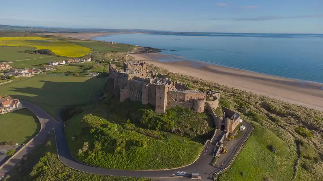
Further north, the trail passes Beadnell, Seahouses and Bamburgh Castle, with views towards the Farne Islands. Beyond Bamburgh, the route reaches Budle Bay and the coastal landscapes around Holy Island, also known as Lindisfarne. The island is reached by a tidal causeway, where safe crossing times must be checked carefully. Lindisfarne Priory and the island's historic settlement are important landmarks along this part of the Northumberland coast.
The final section continues north through the coastal countryside towards Berwick-upon-Tweed, crossing the River Tweed before following the coast towards the Scottish border at Marshall Meadows. Here, the North East section concludes, completing a journey through some of England's most varied coastal landscapes.
Overview
Distance: Approximately 328 miles / 528 km (measured GPX route; official consolidated distance not verified)
Typical duration: Approximately 4–6 weeks
Difficulty: Moderate to Challenging
Start: Humber Bridge, Hessle
Finish: Scottish border, near Marshall Meadows
Terrain: Estuary paths, coastal promenades, sandy beaches, chalk and limestone cliffs, dunes, farmland, woodland, urban waterfronts, tidal crossings and coastal tracks.
Check availability
Select your dates to check current availability and prices.