
Walk the Cleveland Way
The Cleveland Way is a 109-mile National Trail from Helmsley to Filey in North Yorkshire. The route combines the upland landscapes of the North York Moors National Park with a long stretch of the Yorkshire coast, creating a trail of two distinct halves between the market towns, moorland, cliffs and coastal settlements of north-east Yorkshire.
From Helmsley, the Cleveland Way heads north towards the western edge of the North York Moors. The route climbs from the town through countryside and woodland before reaching higher ground and the open landscapes of the National Park.
The trail continues across the western escarpment of the North York Moors towards Sutton Bank. Woodland, farmland and open moorland accompany extensive views west across the Vale of Mowbray.
Beyond Sutton Bank, the Cleveland Way follows the edge of the moors towards Osmotherley before turning east into increasingly open upland country. Heather moorland, rocky tracks and broad views become characteristic of the route as it crosses the northern part of the National Park.
The trail continues across the Cleveland Hills, passing landmarks including the Wainstones and crossing high ground around Urra Moor. Steep ascents and descents punctuate this section as the route makes its way towards the eastern edge of the moors.
From the moorland, the Cleveland Way descends towards Saltburn-by-the-Sea, where the character of the trail changes significantly. The route reaches the North Sea and turns south to begin its long journey along the Yorkshire coast.
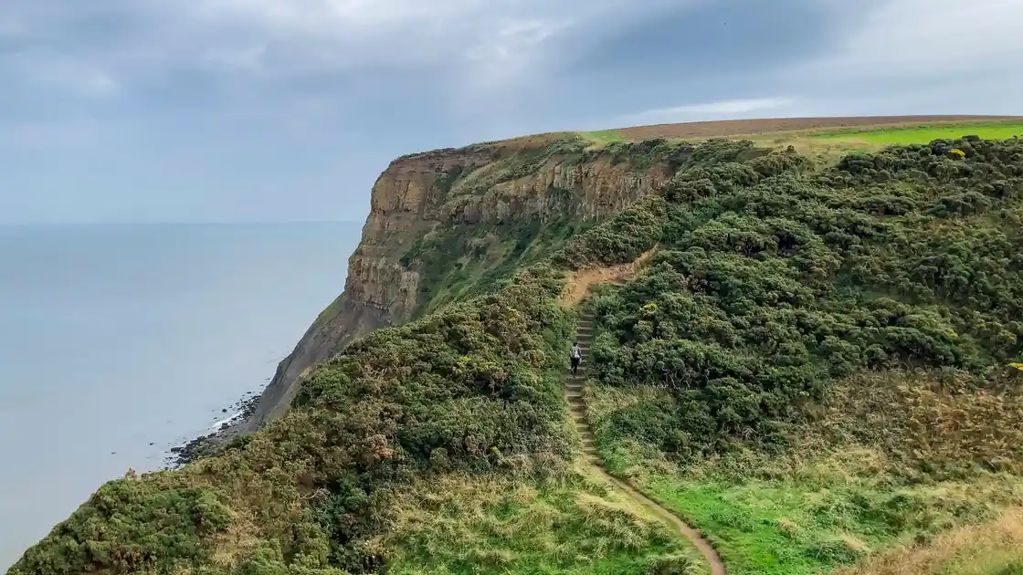
Beyond Saltburn, the Cleveland Way follows cliffs and coastal paths through villages including Staithes and Runswick Bay. Fishing villages, rocky bays and high sea cliffs replace the open moorland landscapes of the earlier stages.
The route continues south towards Whitby, one of the principal towns on the trail. From Whitby, the Cleveland Way climbs back onto the cliffs and follows the coast towards Robin Hood's Bay, with extensive views along the coastline.
Beyond Robin Hood's Bay, the trail continues along the cliffs towards Ravenscar. The route passes a succession of coastal valleys and headlands as it approaches the higher cliffs north of Scarborough.
From Scarborough, the Cleveland Way follows the coast south towards Cayton Bay and Filey. Clifftop paths and views across the North Sea accompany the final stages before the trail reaches Filey Brigg and the end of the National Trail.
Helmsley, Osmotherley, Saltburn-by-the-Sea, Staithes, Whitby, Robin Hood's Bay, Scarborough and Filey provide useful bases along the route. Although the complete Cleveland Way is a substantial long-distance walk, its combination of moorland towns, coastal villages and seaside resorts makes it particularly well suited to shorter sections and stay-based walking breaks.
Overview
Distance: 109 miles / 175 km
Typical duration: 7–10 walking days
Difficulty: Moderate to Challenging
Start: Helmsley, North Yorkshire
Finish: Filey, North Yorkshire
Terrain: Moorland paths, rocky tracks, woodland paths, field paths, cliff-top paths, coastal paths, steep ascents and descents and short road sections
Check availability
Select your dates to check current availability and prices.