
Exploring South Yorkshire
South Yorkshire lies in Yorkshire and the Humber, bordered by West Yorkshire to the north-west, North Yorkshire to the north, the East Riding of Yorkshire to the north-east, Lincolnshire to the east, Nottinghamshire to the south-east and Derbyshire to the south-west. Its landscapes range from the high moorland and gritstone edges of the Pennines to wooded valleys, riverside meadows, reservoirs, farmland and the historic industrial landscapes of the Don and Dearne valleys.
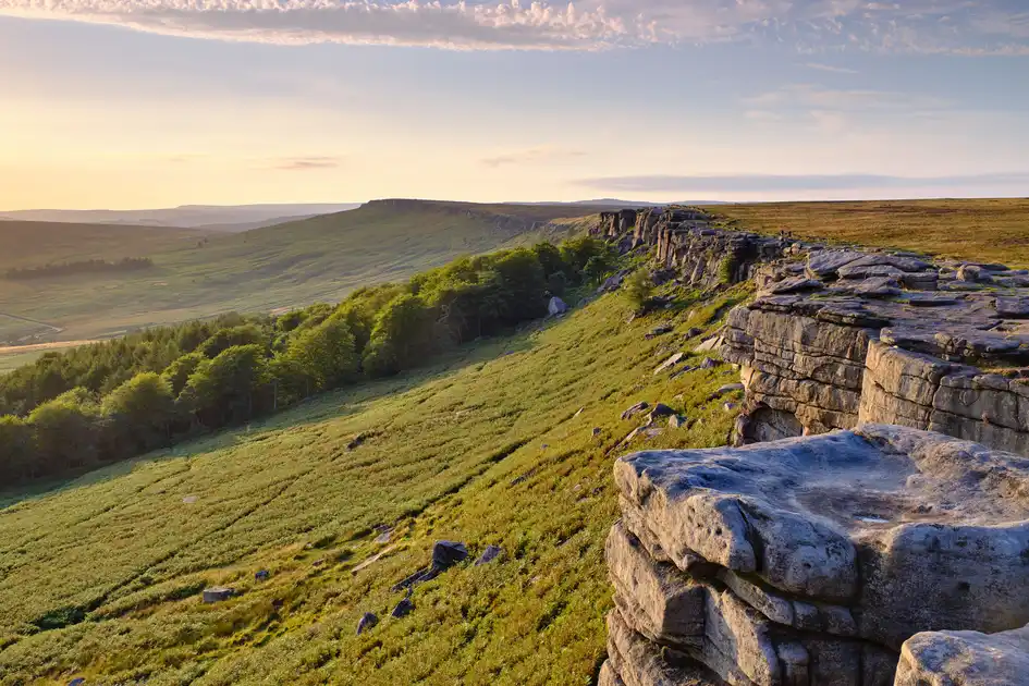
The western edge of South Yorkshire reaches into the Peak District National Park, where open moorland, gritstone escarpments, reservoirs and steep-sided valleys provide some of the county's most dramatic walking landscapes. Around the Sheffield border, places such as Stanage Edge, the Burbage Valley and the moorlands above Langsett offer access to upland paths, woodland trails and longer walks into the national park.
The countryside around Sheffield is particularly varied, with wooded valleys, reservoirs and open moorland extending west from the city towards the Pennines. The Rivelin, Loxley, Porter and Sheaf valleys provide routes through woodland, parks and historic mill landscapes, while the reservoirs around Redmires, Damflask and Langsett connect local walks with the surrounding hills. Sheffield's network of green spaces and countryside paths makes it possible to explore substantial areas of woodland and rural landscape close to the city.
Further north, the countryside around Barnsley includes the wooded slopes and valleys of the eastern Pennines, with walking routes around Penistone, the upper Don Valley and the landscapes of the Dearne Valley. The Trans Pennine Trail passes through South Yorkshire, connecting former railway lines, canal towpaths, countryside routes and settlements as part of a wider network of walking and cycling paths across northern England.
The River Don flows through the county from the Pennine foothills towards Doncaster, passing Sheffield and Rotherham along the way. Its valley reflects South Yorkshire's industrial heritage, with former mills, canals, railways and riverside landscapes now connected by paths and green corridors. The Five Weirs Walk follows the Don through Sheffield, while the Don Valley and surrounding countryside provide opportunities for longer riverside walks.
East of Rotherham and Doncaster, the landscape becomes more open, with farmland, river valleys, wetlands and historic villages. The countryside around the River Dearne and the lower Don includes nature reserves, former industrial sites and restored wetland habitats. The Dearne Valley wetlands, including areas around Old Moor, provide walking routes through reedbeds, grassland and lakes, with opportunities for birdwatching and exploring the changing landscape.
Long-distance walking routes connect South Yorkshire with neighbouring counties. The Sheffield Country Walk forms a circular route around the city's rural fringes, while the Barnsley Boundary Walk explores countryside, villages and valleys around the borough. The Trans Pennine Trail provides connections between the county's towns, countryside and neighbouring regions.
South Yorkshire's towns and villages also provide starting points for shorter walks and walking breaks. Penistone, Wentworth, Elsecar and the villages west of Sheffield offer access to historic estates, reservoirs, countryside paths and former industrial landscapes. Around Doncaster, riverside routes, country parks and nature reserves provide a contrast to the more rugged uplands of the western county.
From the gritstone edges and moorlands of the Peak District to Sheffield's wooded valleys, the Pennine foothills around Barnsley and the rivers and wetlands of eastern South Yorkshire, the county can be explored through local walks, countryside trails and longer routes, with accommodation in towns, villages and rural locations across the county.
Check availability
Select your dates to check current availability and prices.