
GR5 Nice to Briançon
Mediterranean slopes, high passes, and a journey into the southern French Alps.
The GR5 from Nice to Briançon follows a northbound route from the Mediterranean coast into the high landscapes of the southern French Alps. Forming part of the Grande Traversée des Alpes, the trail links mountain routes, alpine landscapes, and remote settlements through a continuous progression from sea level to some of the highest terrain in southern France.
As a self-guided journey, the route connects places such as Nice, Saint-Martin-Vésubie, the Mercantour region, Maljasset, and Briançon while passing through mountain forests, alpine meadows, rocky passes, and high valleys. Long ascents and sustained days on elevated ground define the route, with each stage carrying walkers further from the Mediterranean and deeper into the Alps.
The landscape changes gradually as the route gains altitude. Terraced hillsides and wooded slopes above the Côte d'Azur give way to the rugged mountains of Mercantour National Park, where larch forests, glacial lakes, and exposed passes dominate the terrain. Further north, the trail enters quieter borderland valleys and high pastoral landscapes, where historic transhumance routes and remote settlements reflect centuries of mountain life.
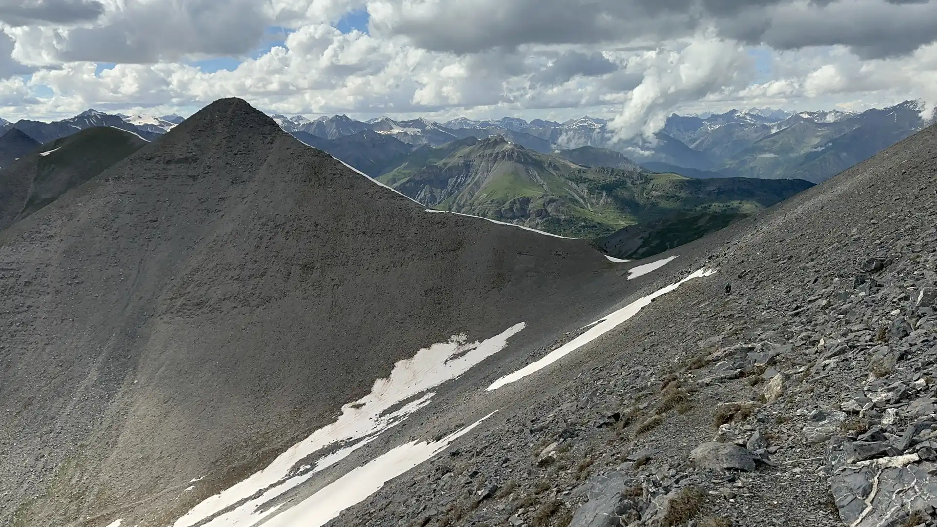
Beyond Mercantour, the route continues through the upper valleys of the southern Alps toward the Queyras region and Briançon. Here, broad mountain scenery, high pastures, and traditional alpine villages create a different rhythm to the journey while maintaining the sense of continuous northward progression. Throughout, the trail remains focused on movement between valleys and passes rather than individual summits.
With mountain refuges, alpine villages, and established long-distance paths throughout much of the route, the GR5 offers one of Europe's classic mountain journeys. The trail combines Mediterranean influences, alpine scenery, and high mountain walking, creating a remarkable transition between coast and mountains over a sustained period on foot.
Overview
Distance 136 miles / 219 km
Duration 10–14 days
Difficulty Challenging
Start Nice, Alpes-Maritimes
Finish Briançon, Hautes-Alpes
Terrain Mountain passes, alpine tracks, rocky ridges, forest trails, high pastures, and valley roads
Field Trip: Walking the GR5 from Nice to Briançon
This short film documents a self-guided journey on the GR5 between Nice and Briançon, recorded on the trail itself. It shows the terrain, gradients, and day-to-day walking conditions across the French Alps, supporting the route overview above with real on-ground context.

Field footage from the GR5 showing typical trail conditions between Nice and Briançon.
