
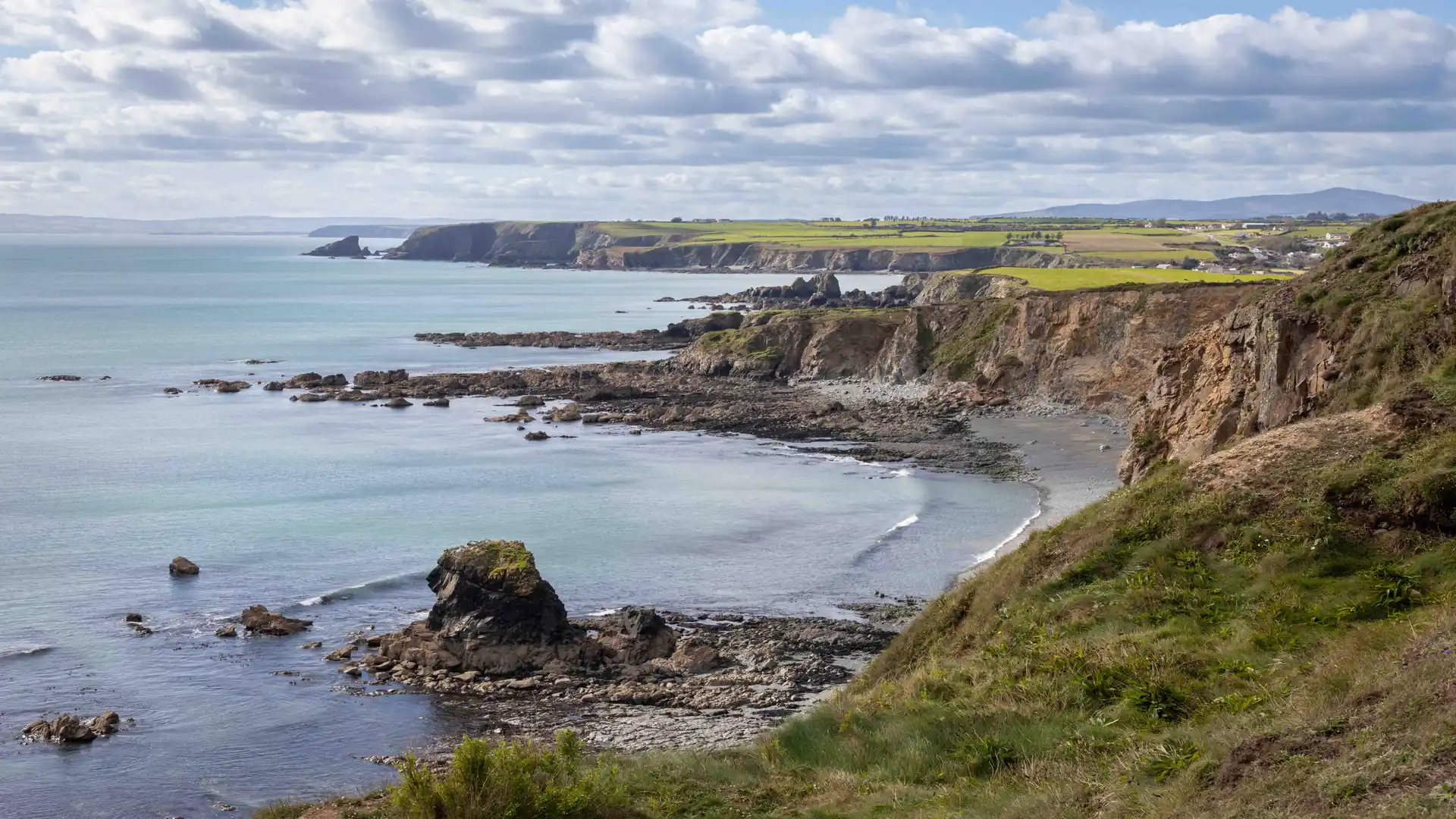
Clifftop shoreline, rounded uplands, and wide valleys along Ireland’s south-east coast.
County Waterford is a coastal county of headlands, low mountains, and river valleys in south-east Ireland. Walking routes cross the Copper Coast UNESCO Global Geopark and follow the Waterford Greenway and Comeragh Mountain paths, linking places such as Waterford City, Tramore, Dungarvan, Ardmore, and Lismore across coastal tracks, railway paths, and upland ground between the Celtic Sea and the River Blackwater valley.
Much of the terrain is firm and moderately rolling underfoot. Greenway surfaces, minor roads, clifftop paths, woodland tracks, and mountain trails allow steady progress, with short, regular climbs onto headlands and upland ridges rather than sustained ascent. Surfaces are generally compact gravel or tarmac on the Greenway, with rougher ground on hills and coastal sections.
The landscape shifts between areas. The Copper Coast forms exposed cliffs and coves west of Tramore, while the Comeragh Mountains rise inland with steeper slopes, corries, and upland plateaus. Toward Dungarvan and Lismore, valleys and farmland become broader and lower, with quieter inland routes along rivers and lanes.
Towns and villages are spaced along the coast and valley corridors, creating regular access points for short linear walks and longer point-to-point routes, with longer open stretches across upland ground.
Trails and Routes Through County Waterford
Waterford Greenway
Continuous off-road path on a former railway line between Waterford City and Dungarvan following river and valley ground with mostly level gradients.
Copper Coast Coastal Walks
Clifftop and shoreline paths between Tramore and Dungarvan using minor roads, tracks, and exposed headland sections.
Comeragh Mountain Paths
Hill and upland routes across the Comeragh range with steeper climbs, rocky ground, and open terrain.
Blackwater Valley Routes
Riverside and farmland walking around Lismore and Cappoquin on quieter inland ground.
Walking Character
- Cliffs, coves, and headlands
- Rounded upland mountains
- River valleys and farmland
- Railway greenway and level paths
- Short, regular climbs
- Mixed gravel, tarmac, and rough ground
- Coastal and inland routes within a compact area
Check availability
Select your dates to check current availability and prices.