Coastal headlands, mountain passes, and a full circuit of the Dingle Peninsula
The Dingle Way forms a complete loop around the Dingle Peninsula in County Kerry, West of Ireland, following a line of walking routes, landscapes, and places shaped by mountain, pasture, and sea. Beginning and ending in Tralee, it traces the outer edge of the peninsula through quiet farmland, long beaches, and upland passes, linking villages and harbours in a continuous journey on foot.
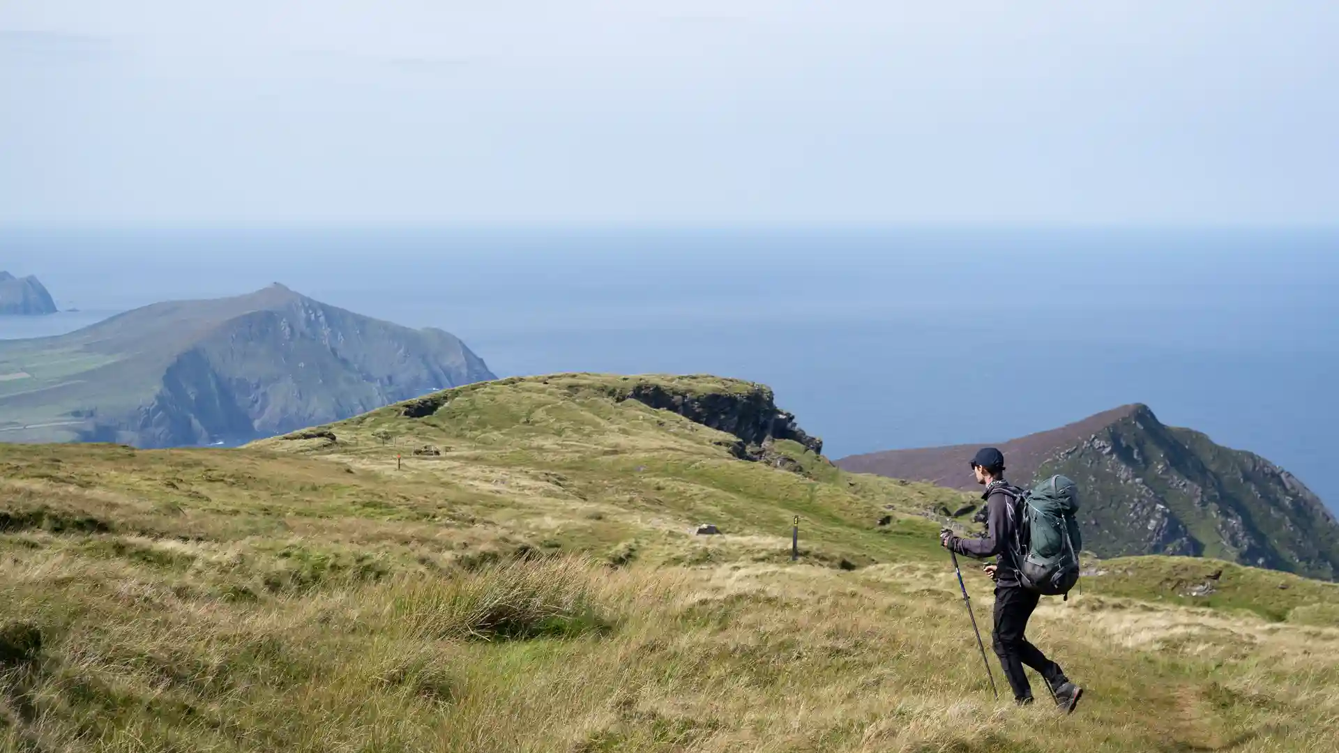
Walking here is defined by change rather than difficulty. The route moves between shoreline and high ground, from the wide strands of Brandon Bay to narrow tracks climbing into the Slieve Mish and Brandon Mountains. Progress feels steady and measured. One moment the sea sits level with the path; the next the land rises into open hills where views extend across fields, islands, and Atlantic water.
The terrain follows the natural grain of the peninsula. Sandy beaches, grassy tracks, and quiet lanes connect farms and townlands, while stone walls and hedged fields create a sense of enclosure before the landscape opens again toward the coast. Inland sections feel sheltered and rural; headlands and passes feel exposed and wind-shaped. The rhythm comes from these small transitions rather than any single dramatic point.
Settlements appear at regular intervals and feel part of the route rather than separate from it. Camp, Annascaul, Dingle, Dunquin, Cloghane, and Castlegregory gather around harbours, bridges, and crossroads, offering natural pauses between longer stretches of open ground. These villages anchor the walk, providing continuity and a human scale to the landscape.
As the loop closes back toward Tralee, mountain gives way to low pasture and shoreline once more. The sense is not of finishing but of having circled the peninsula — sea, stone, and sky encountered from every side.
For many walkers, the appeal of the Dingle Way lies in this completeness. It is a route shaped less by spectacle and more by steady movement through connected places, revealing how coast, mountain, and settlement fit together when experienced slowly, on foot.
Trail Overview
Distance
111 miles / 179 km
Typical time on foot
8–10 days
Start
Tralee, County Kerry
Finish
Tralee, County Kerry (circular route)
Terrain
Coastal paths, sandy beaches, mountain tracks, farmland lanes, quiet roads, villages, and harbour towns
Waymarking
National Waymarked Trail symbols
