West of Ireland – Cliffs, Bogland, and Atlantic Mountains
Coastlines, limestone hills, and long-established paths shaped by weather, water, and settlement
Atlantic headlands, limestone pavements, and wide stretches of bogland shape the West of Ireland, where routes such as the Western Way and trails across the The Burren link the coasts of County Clare and County Mayo with mountain valleys, villages, and shoreline, creating one of Ireland’s most distinctive regions for steady, self-guided movement between upland and sea.
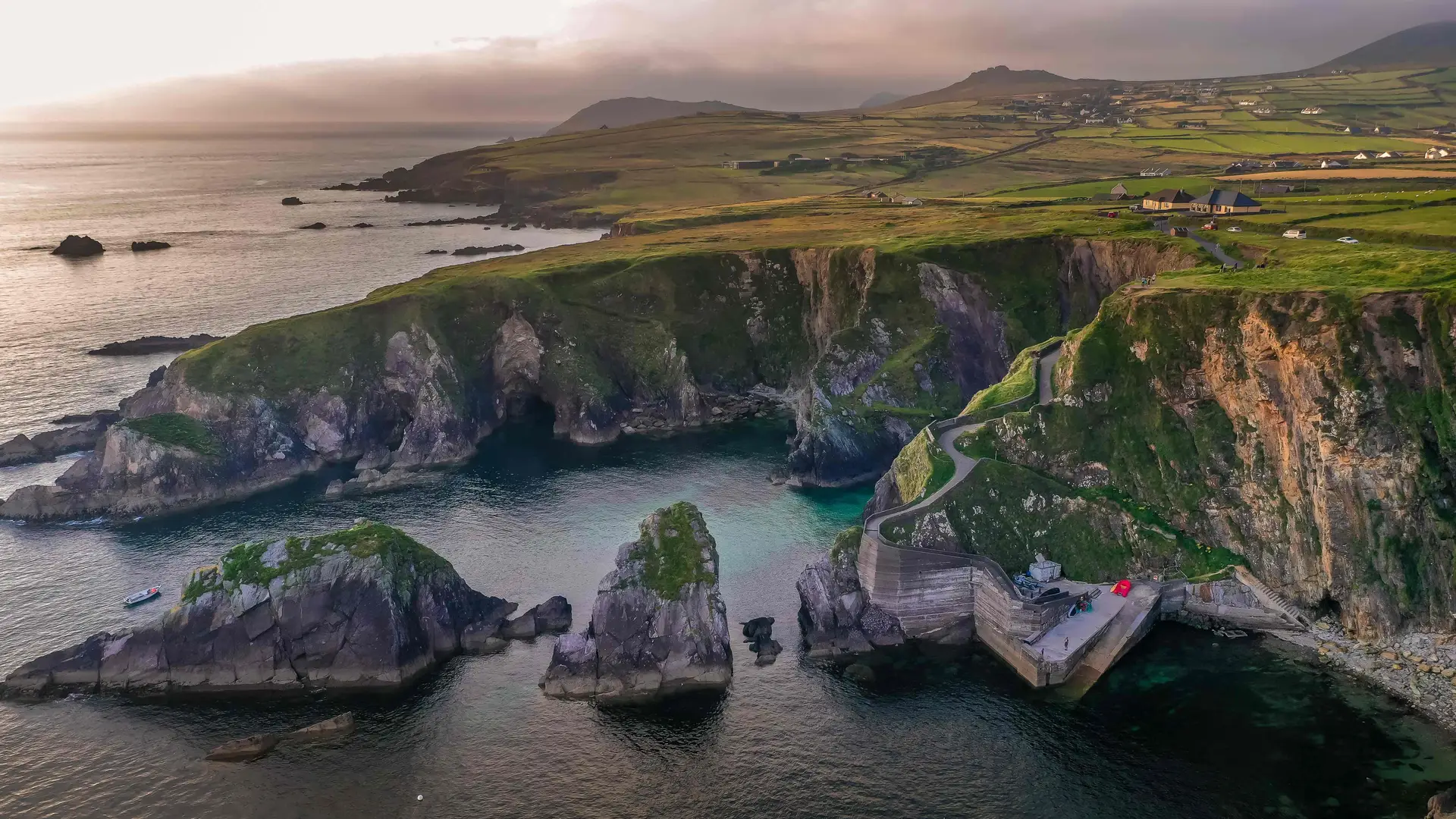
The geography shifts quickly across short distances. Along the coast, cliffs and headlands rise directly above the Atlantic, with beaches, harbours, and tidal inlets set between them. Inland, blanket bog and heath stretch across open ground, while the Maumturk and Twelve Bens ranges lift into rocky ridges and glens. Further south, the Burren forms a limestone landscape of pavements, dry valleys, and scattered stone walls. Routes move naturally between these environments, allowing days on foot that feel varied without abrupt transition.
Much of the region is protected. Connemara National Park safeguards upland mountains, bog, and heathland walking, while Burren National Park protects limestone hills, rare flora, and archaeological sites. Coastal habitats and headlands along Galway Bay, Clew Bay, and Clare’s Atlantic edge preserve dunes, wetlands, and traditional farmland. Together these areas maintain wildlife, heritage, and long-established rural life, with paths passing easily between field, coast, and settlement.
Movement through the West often follows historic and natural lines. Old boreens, pilgrimage paths, shoreline tracks, and mountain passes continue to guide today’s trails. The Western Way runs north–south through Connemara and Mayo, linking valleys, villages, and upland terrain. The Burren Way crosses limestone country between Lahinch and Corofin, while coastal routes trace the Cliffs of Moher and the shores of Clew Bay. These paths reveal how closely walking here is tied to land, weather, and everyday life.
Walking is shaped by rhythm and exposure. Villages, harbours, and small towns appear at intervals across wide stretches of open country, offering natural pauses without breaking the sense of space. Coast, mountain, and bog feel closely connected, encouraging longer journeys through landscapes that feel expansive, quiet, and elemental.
This is a region best understood step by step: along Atlantic cliffs, across limestone hills, and between long-settled communities where land and sea remain inseparable.
Routes & Landscapes Across the Region
Connemara National Park and the Western Way provide upland and valley walking across bogland, mountains, and coastal inlets between Oughterard, Leenane, and Westport.
The Burren National Park and Burren Way offer limestone plateau routes through dry valleys, historic sites, and small farming communities, while the Cliffs of Moher coastal path follows high headlands above the Atlantic between Liscannor and Doolin.
Croagh Patrick and Clew Bay combine mountain and shoreline walking, and the Great Western Greenway provides a level, traffic-free route linking Westport with Achill through open countryside.
Counties of the West of Ireland
Galway, Mayo, and Clare each offer distinct variations of coast, mountain, bogland, and limestone landscapes, providing natural bases for longer regional journeys between village, upland, and sea.
Beginning to explore the West of Ireland
The West of Ireland’s trails, protected landscapes, and historic paths form a connected network rather than a single destination. Following its coastline, hills, and valleys reveals how weather, settlement, and tradition continue to shape movement through one of Ireland’s most atmospheric regions.
Frequently Asked Questions
What defines walking in the West of Ireland?
Clifftop paths, bogland tracks, limestone hills, mountain ridges, and coastal routes connecting villages and harbours.
Are there long-distance trails in the region?
Yes. Key routes include the Western Way, Burren Way, Cliffs of Moher Coastal Walk, and the Great Western Greenway.
Is the terrain challenging?
Terrain ranges from gentle coastal and greenway routes to more exposed mountain and upland sections.
Are there protected landscapes?
Yes. The region includes Connemara National Park and Burren National Park, along with extensive protected coastal and upland environments.
Can routes be linked together?
Yes. Many trails pass through towns and villages, making it easy to combine coastal, upland, and inland routes into longer journeys.