
Hadrian’s Wall Path
Stone walls, open moorland, and a journey across northern England.
The Hadrian's Wall Path is a long-distance National Trail running from Wallsend on the River Tyne to Bowness-on-Solway on the Cumbrian coast. Following the line of the Roman frontier across northern England, the route links historic sites, upland landscapes, farmland, and coastal marshes through a continuous coast-to-coast journey shaped by both archaeology and landscape.
As a self-guided journey, the route connects places such as Wallsend, Chollerford, Housesteads, Steel Rigg, Carlisle, and Bowness-on-Solway while passing through the Hadrian's Wall UNESCO World Heritage Site and Northumberland National Park. Roman forts, defensive earthworks, ridge-top paths, and open countryside create a route defined by history, distance, and a strong sense of progression across the country.
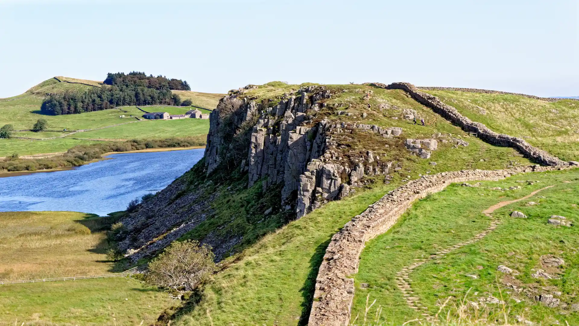
The character of the trail changes gradually as it moves west. Urban riverside paths and farmland give way to the dramatic Whin Sill escarpment, where some of the best-preserved sections of Hadrian's Wall follow high ridges above lakes and moorland. Beyond the central crags, the landscape softens into river valleys, pasture, and the open coastal marshes of the Solway Plain.
With clear National Trail waymarking, regular accommodation options, and access to historic sites throughout the route, Hadrian's Wall Path offers one of England's most distinctive long-distance walking journeys. The trail combines heritage, landscape, and coast-to-coast travel, revealing the changing character of northern England through a route shaped by nearly two thousand years of history.
Overview
Distance 84 miles / 135 km
Duration 5–7 days
Difficulty Moderate
Start Wallsend, Newcastle upon Tyne
Finish Bowness-on-Solway, Cumbria
Terrain Farmland paths, ridge walking, moorland tracks, quiet lanes, river valleys, and coastal marsh
