Briançon UNESCO World Heritage Site – Mountain Fortifications of Vauban
Stone Ramparts, Alpine Routes, and High Valley Landscapes
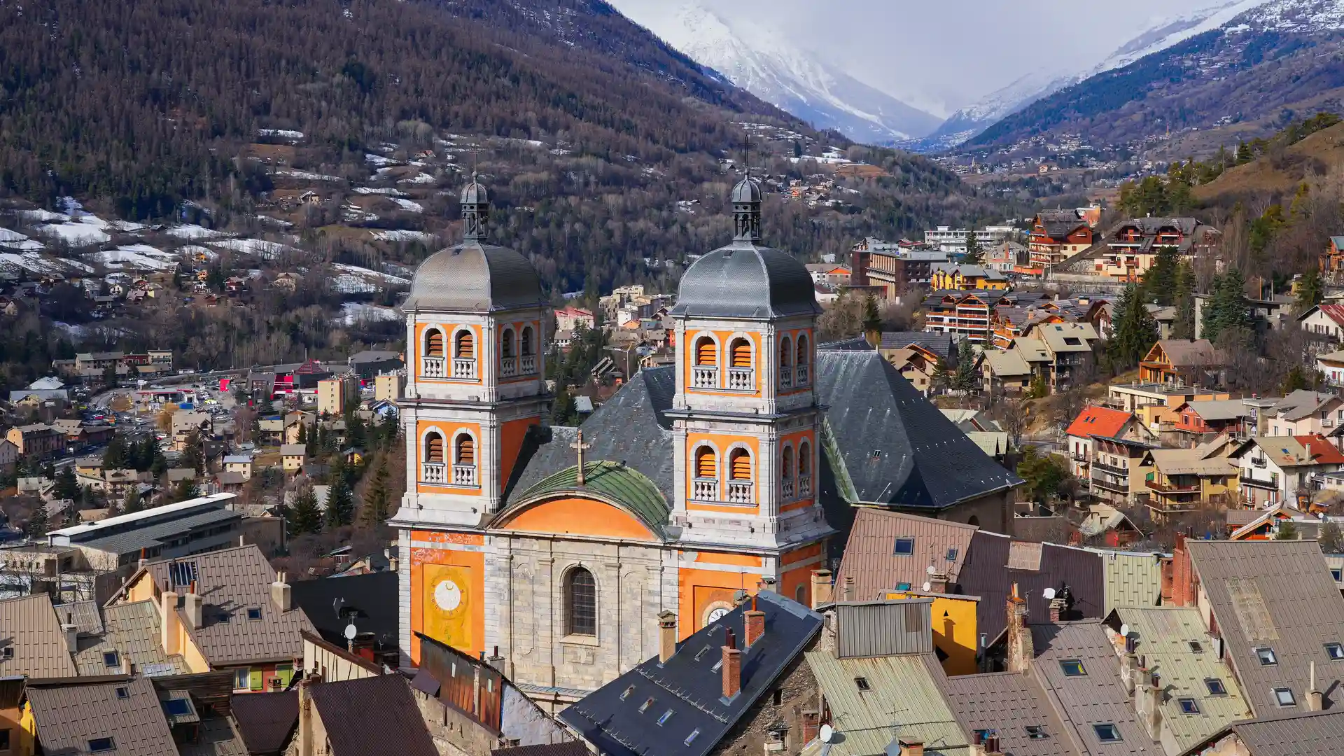
Briançon is one of the French Alps’ most distinctive places for self-guided travel, shaped by walking routes, high mountain landscapes, and historic places set at the meeting point of major alpine valleys in the Hautes-Alpes. Paths rise directly from the fortified old town toward surrounding passes and ridgelines, while long-distance routes such as the GR5 connect Briançon with neighbouring valleys, borderlands, and the wider Alpine range, allowing walkers to move gradually between settlement and mountain terrain rather than treating the town as a single stop.
The setting is defined by altitude and exposure. Stone ramparts overlook deep river valleys, steep slopes climb quickly into open alpine pastures, and high passes lead toward Italy and the southern Alps. Historic streets sit only minutes from trailheads, creating an immediate transition from fortified walls to upland paths.
Despite its military origins, Briançon feels calm and lived-in. Daily life unfolds within the Cité Vauban while footpaths and mule tracks trace centuries of movement through the mountains. Exploring on foot reveals how closely defence, travel, and landscape have always been connected in this part of the Alps.
About the UNESCO World Heritage Site
Briançon was inscribed in 2008 as part of the “Fortifications of Vauban” UNESCO World Heritage Site, recognising a network of military works designed or influenced by the engineer Sébastien Le Prestre de Vauban.
Here, fortification design was adapted to extreme alpine conditions. Walls, bastions, and outlying forts were positioned to control key passes between France and Italy, including the Col de Montgenèvre. Together they form one of the most complete examples of high-altitude defensive planning in Europe.
Unlike isolated monuments, the fortifications remain integrated into a living mountain town, where streets, terraces, and paths continue to shape everyday movement through the landscape.
Where to Walk
GR5 – Alpine Section
The long-distance route linking the North Sea to the Mediterranean passes directly through Briançon, connecting the town with high passes and neighbouring valleys.
Tour du Mont Thabor
A multi-day circuit through remote valleys and alpine terrain near the French–Italian frontier.
Col de Montgenèvre Paths
Historic and modern routes crossing one of the Alps’ most important passes between Briançon and Italy.
Upper Durance Valley Trails
Gentler valley walking along river corridors linking nearby villages and rail-access points.
Serre Chevalier Slopes & Forest Paths
Woodland and hillside routes rising above the town with wide views across the valley.
Highlights
- UNESCO-listed Vauban fortifications integrated into a living alpine town
- One of Europe’s highest historic fortified settlements
- Direct access to the GR5 long-distance walking route
- Historic passes linking France and Italy
- Immediate transition from town streets to high mountain terrain
- Strong rail connections supporting car-free alpine travel
- A rare combination of cultural heritage and mountain landscape