Suffolk & Essex Coast & Heaths National Landscape – Shingle Shores, Heathland, and Big Skies
A Low-Lying Coastal Landscape Shaped by Shingle, Heath, and Estuaries
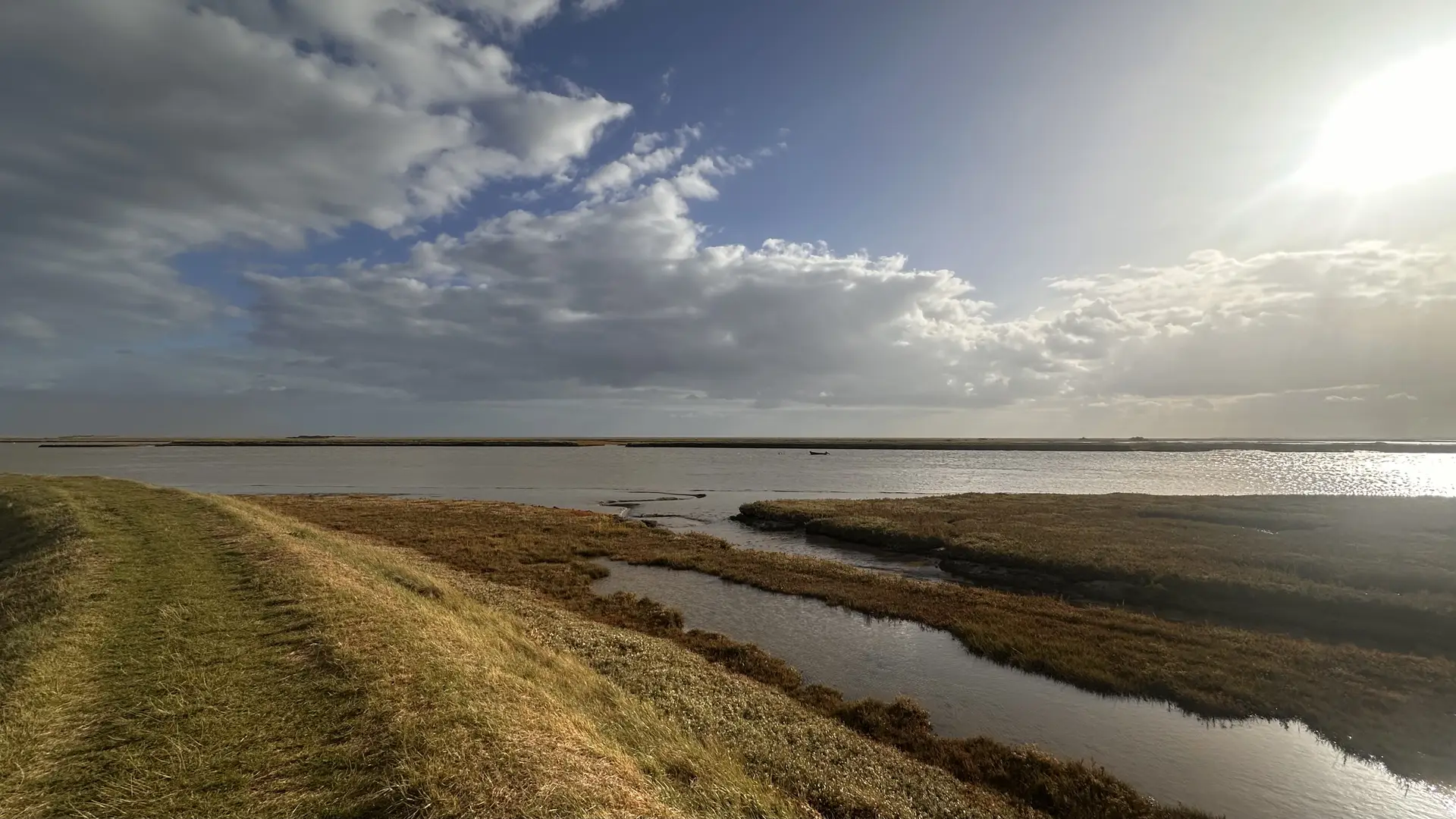
The Suffolk & Essex Coast & Heaths National Landscape — formerly designated as the Suffolk Coast & Heaths Area of Outstanding Natural Beauty — is one of England’s most peaceful and ecologically rich coastal regions, forming a distinctive part of the East of England. Shaped by wide shingle beaches, quiet estuaries, open heathland, pine forests, and low coastal cliffs, the landscape stretches from Lowestoft in the north to the Stour Estuary in the south, crossing the Suffolk–Essex boundary.
This is a landscape defined by space, light, and movement. Big skies sit above shifting shorelines, tidal rivers cut inland through grazing marsh, and low sandy soils support some of the country’s most important heathland habitats. Walking routes move easily between coast, woodland, estuary, and village, creating calm, connected journeys through one of England’s most understated protected landscapes.
Long-distance routes such as the Suffolk Coast Path, Sandlings Walk, and Stour and Orwell Walk thread together coastal towns, nature reserves, and historic settlements including Southwold, Aldeburgh, Dunwich, Orford, Woodbridge, and Manningtree. Inland, forest tracks and riverside paths offer quieter alternatives to shoreline walking, with long views across reedbeds, mudflats, and tidal creeks.
Walking here is shaped as much by atmosphere as distance. Shingle crunches underfoot along exposed beaches, while inland paths wind through pinewoods and open heath alive with birds and deer. Tides, weather, and light constantly change the character of routes, giving even familiar sections a different feel from day to day.
Wildlife is a defining presence. Marsh harriers quarter reedbeds at Minsmere, bitterns boom from hidden wetlands, seals haul out along quieter beaches, and migrating birds move through the estuaries in vast seasonal numbers. Many of these encounters unfold directly alongside walking routes, making wildlife part of the journey rather than a separate destination.
Beyond walking, the landscape lends itself naturally to low-impact outdoor exploration. Estuary paddling, wildlife photography, forest cycling, and quiet coastal travel all suit the flat terrain and unhurried rhythm of the area. The absence of steep ground encourages slower movement and longer time spent in each place.
Cycling is particularly well suited to the region. Quiet lanes, forest tracks, and estuary-side routes link villages, beaches, and nature reserves, allowing relaxed journeys between places such as Woodbridge, Aldeburgh, Southwold, and Felixstowe Ferry. Gentle distances make it easy to combine walking and cycling within a single trip.
Accommodation is spread naturally through coastal towns and riverside villages, with strong rail connections to Lowestoft, Saxmundham, Ipswich, and Woodbridge supporting car-free travel. This structure reinforces the sense of moving steadily through a lived-in landscape rather than entering a single focal site.
For those seeking quiet coastal walking, wildlife-rich routes, and connected journeys across coast and countryside, the Suffolk & Essex Coast & Heaths National Landscape offers one of England’s most rewarding environments for slow, self-guided travel.
Where to Walk and Explore
Suffolk Coast Path
A long-distance coastal route following beaches, shingle shores, low cliffs, saltmarsh, and harbour towns between Felixstowe and Lowestoft.
Sandlings Walk
An inland route linking Ipswich and Southwold across heathland, forest tracks, and sandy soils shaped by ancient woodland and common land.
Stour and Orwell Walk
A riverside journey following both estuaries through wooded slopes, tidal creeks, and waterside villages to the Essex border.
Dunwich Heath and Minsmere
Open heathland, reedbeds, and shingle shoreline supporting internationally important birdlife and some of the area’s most distinctive walking routes.
Forest and Estuary Circular Walks
Shorter routes through Rendlesham Forest, Sutton Heath, and along the Alde, Deben, and Blyth estuaries.
Landscape Highlights
- Shingle beaches, saltmarsh, and tidal estuaries
- Open heathland and pine forest on sandy soils
- Wildlife-rich reserves with year-round interest
- Quiet coastal towns and historic riverside villages
- Flat, accessible terrain for relaxed walking and cycling
- Strong rail access supporting car-free journeys
Frequently Asked Questions
What is the Suffolk & Essex Coast & Heaths National Landscape known for?
It is known for its quiet shingle beaches, open heathland, tidal estuaries, pine forests, and outstanding wildlife. The landscape is particularly valued for its sense of space and calm.
Are there long-distance walking routes here?
Yes. The Suffolk Coast Path, Sandlings Walk, and Stour and Orwell Walk all pass through the National Landscape.
Can the area be explored without a car?
Yes. Rail connections to Lowestoft, Saxmundham, Ipswich, and Woodbridge, combined with local buses, make car-free exploration practical.
What wildlife can be seen?
Marsh harriers, bitterns, seals, deer, and large numbers of migrating birds are commonly seen throughout the year.
Which places make good bases?
Southwold, Aldeburgh, Orford, Woodbridge, and Manningtree all provide strong access to walking routes, estuaries, and coastal landscapes.