Cornwall – Clifftop Coast Paths, Moorland, and Atlantic Walking
Atlantic headlands, sandy coves, and upland moor between the Celtic Sea and the English Channel
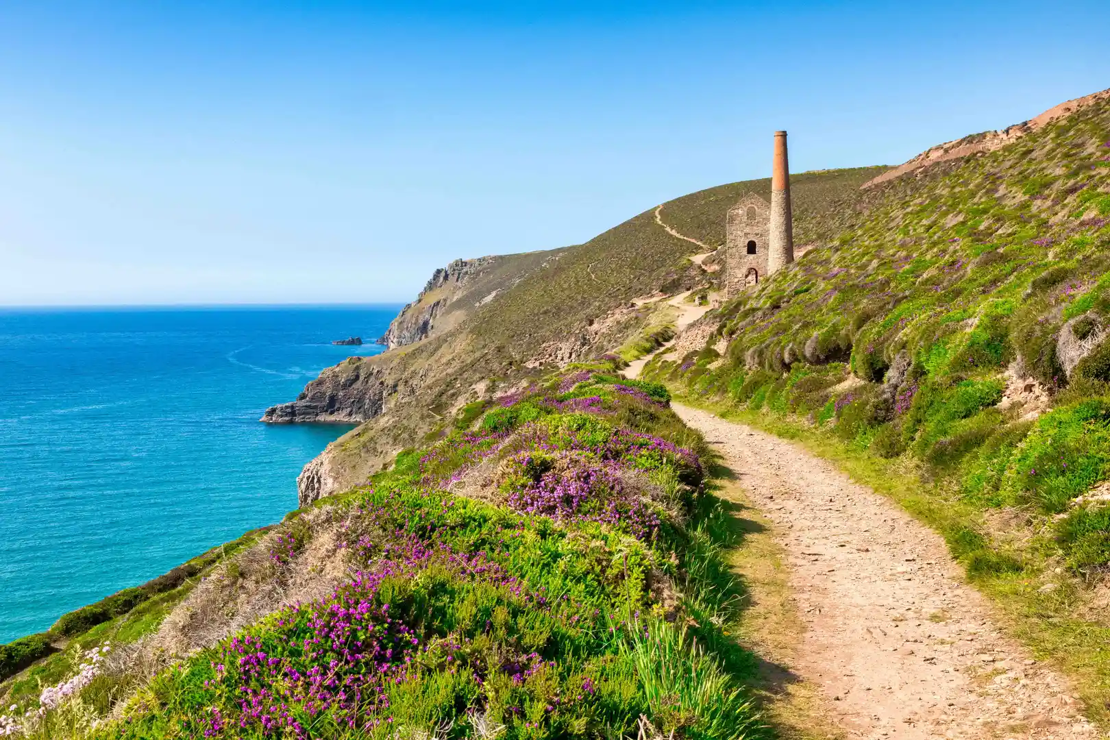
Cliffs, beaches, estuaries, and open moorland shape Cornwall, where walking routes cross the Cornwall National Landscape and the Tamar Valley National Landscape and follow the South West Coast Path through the Cornwall and West Devon Mining Landscape UNESCO World Heritage Site between St Ives, Penzance, Falmouth, Newquay, Padstow, and Bude along exposed headlands, harbour towns, and inland hills.
Much of the terrain is firm but varied underfoot. Cliff paths, sandy stretches, grassy tracks, and stone steps create steady but undulating progress, with frequent short climbs and descents rather than sustained high-level walking.
The landscape changes across the county. The north and west coasts are defined by rugged cliffs and surf beaches, while the south coast includes sheltered creeks and wooded estuaries. Inland, Bodmin Moor rises into open granite upland with rough grassland, tors, and wide views across the peninsula.
Towns and fishing villages are spaced regularly along the coast and estuaries, creating practical start and finish points for both day walks and longer point-to-point routes.
Trails and Routes Through Cornwall
South West Coast Path
A National Trail following the entire Cornish coastline, linking cliffs, beaches, coves, and harbour towns with continuous long-distance walking.
Bodmin Moor paths
Open moorland tracks and bridleways crossing granite tors, reservoirs, and wide upland ground between Rough Tor and Brown Willy.
Saints’ Way
An inland route between Padstow and Fowey crossing farmland, wooded valleys, and low hills across central Cornwall.
Camel Trail
A level multi-use path along a former railway between Padstow, Wadebridge, and Bodmin following the Camel estuary and river valley.
Tamar Valley paths
Riverside and woodland trails along the Devon–Cornwall border through wooded slopes and historic mining landscapes.
Walking Character
• High Atlantic cliffs and headlands
• Sandy beaches and tidal coves
• Estuaries and wooded creeks
• Granite moorland and open tors
• Fishing villages and small harbours
• Frequent climbs with varied coastal terrain