Ireland’s Ancient East – Valleys, Heritage Paths, and Story-Led Landscapes
Sacred valleys, wooded hills, and long-settled paths shaped by history, water, and memory
Ireland’s Ancient East is defined by self-guided travel, walking routes, gentle landscapes, and the places connected by them. Trails such as the Wicklow Way move through Wicklow Mountains National Park and the monastic valley of Glendalough, while riverside and canal paths link towns across the Boyne Valley and Royal Canal corridor, creating a region where movement unfolds steadily between woodland, farmland, heritage sites, and settlement.
This is a landscape shaped less by exposure and more by continuity. Forested hills rise softly above quiet rivers and pasture, while canals and old roads trace long lines between villages, abbeys, and market towns. Routes pass naturally between woodland, field, and stone-built places, revealing a countryside where story and scenery are closely intertwined.
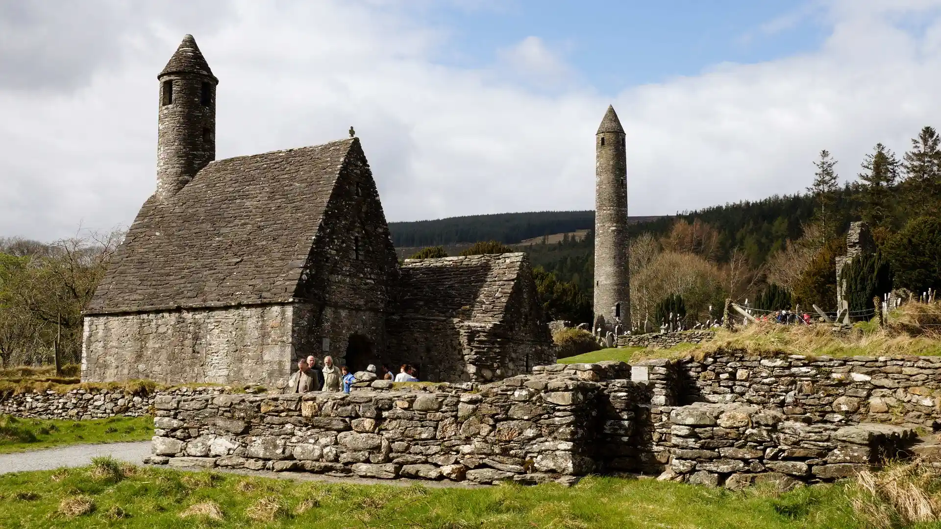
Much of the region’s character comes from its deep human history. Prehistoric tombs, monastic settlements, ringforts, and medieval ruins appear directly beside paths, often forming natural waypoints along the route. In the Boyne Valley, the passage tomb complex of Brú na Bóinne UNESCO World Heritage Site — including Newgrange, Knowth, and Dowth — anchors one of Europe’s most significant archaeological landscapes, while Glendalough’s early Christian settlement remains a focal point within its wooded valley.
Routes frequently follow historic infrastructure. The Wicklow Way threads through upland forest and heath between Dublin’s outskirts and the rolling farmland of Carlow. Canal towpaths such as the Royal Canal and Barrow Way provide level waterside corridors between towns, while shorter heritage paths connect castles, abbeys, and riverside tracks. These established lines make the region easy to explore over several days, with settlements spaced comfortably apart.
Progress is gentle rather than demanding. Gradients are moderate, surfaces varied but manageable, and villages appear regularly, offering natural pauses along the way. Valleys, waterways, and woodland create a feeling of enclosure and calm, encouraging slower travel and longer time outdoors.
This is a region best understood step by step: through wooded glens, along quiet canals, and between places where landscape and memory remain closely intertwined.
Routes & Landscapes Across the Region
The Wicklow Way crosses forest, heath, and upland valleys within Wicklow Mountains National Park between Marlay Park and Clonegal, passing Glendalough, Powerscourt, and wide views across the mountains.
The Royal Canal Greenway follows the historic canal from Maynooth to Cloondara, providing level, traffic-free movement past lock houses, bridges, and wildlife-rich waters.
Boyne Valley trails link the monuments of Brú na Bóinne UNESCO World Heritage Site through farmland and riverside paths, combining archaeology with gentle countryside walking.
The Barrow Way traces the River Barrow southwards through Carlow and Kilkenny, offering quiet waterside routes between towns, locks, and rural landscapes.
Counties of Ireland’s Ancient East
Wicklow, Meath, Kildare, Carlow, Kilkenny, Longford, Westmeath, and surrounding counties each offer distinct combinations of woodland, river valley, farmland, and heritage town, providing natural bases for longer regional journeys.
Beginning to explore Ireland’s Ancient East
Ireland’s Ancient East forms a connected network of trails, protected landscapes, and historic sites rather than a single destination. Following its valleys, canals, and uplands reveals a countryside shaped by settlement and story, where travel feels steady, reflective, and closely tied to place.
Frequently Asked Questions
What defines walking in Ireland’s Ancient East?
Woodland trails, canal towpaths, gentle upland paths, and heritage routes linking villages, rivers, and historic sites.
Are there long-distance routes in the region?
Yes. Key routes include the Wicklow Way, Royal Canal Greenway, Barrow Way, and Boyne Valley heritage trails.
Is the terrain challenging?
Most terrain is moderate and accessible, with gentle gradients and well-established paths, though upland sections in Wicklow can feel more exposed.
Are there protected or historic landscapes?
Yes. The region includes upland parks, river corridors, forest reserves, and many nationally important archaeological and cultural sites.
Can routes be linked together?
Yes. Many trails connect through towns and villages, making it easy to combine valley, canal, and upland routes into longer journeys.