County Tyrone – Low Mountains, Broad Valleys, and Upland Moorland
An inland county of upland ridges, river valleys, and open moorland in the heart of Northern Ireland
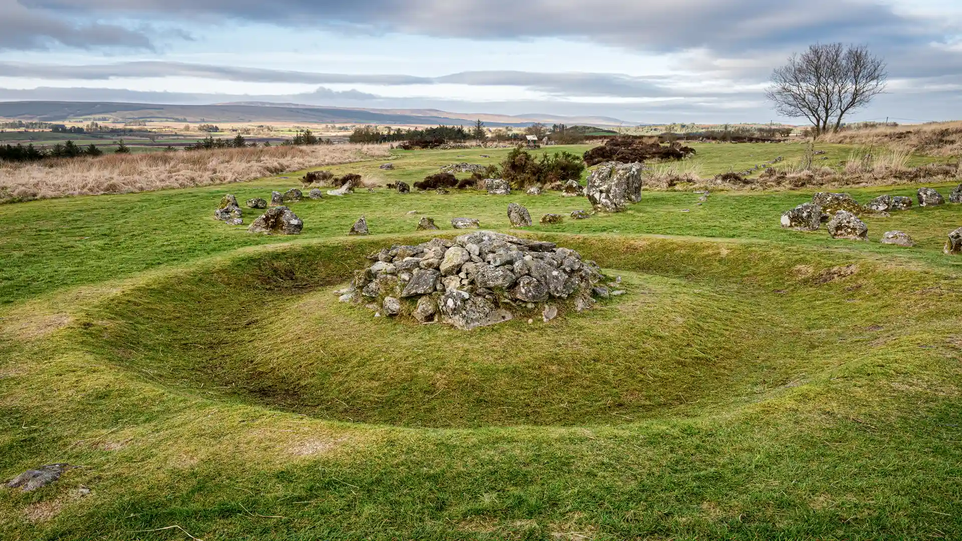
County Tyrone is an inland county of upland ridges, broad valleys, and rolling low mountains in Northern Ireland. Walking routes cross The Sperrins National Landscape, follow sections of the Ulster Way, and use local upland tracks and river-valley paths, linking places such as Omagh, Cookstown, Strabane, Dungannon, and Coalisland across moorland plateaus, farmland, and glens.
Much of the terrain is varied underfoot. Upland sections use rough tracks, open hillside, and peat-edged paths, while lower ground follows field paths, minor roads, and riverside routes. Gradients range from steady climbs onto rounded summits to gentler walking through valleys and settled farmland rather than sustained steep ascent.
The landscape shifts across the county. The north is dominated by the Sperrin Mountains, with broad ridges, exposed moorland, and wide views. Central areas become lower and more agricultural, with drumlin-style farmland and river corridors, while the south and east include gentler uplands and valley ground approaching Lough Neagh’s hinterland.
Towns and villages are lightly spaced, acting as access points rather than continuous corridors, allowing both shorter upland walks and longer point-to-point routes across open countryside without frequent settlement.
Trails and Routes Through County Tyrone
Ulster Way
A long-distance circular route around Northern Ireland, with sections crossing County Tyrone through upland, farmland, and valley landscapes.
Sperrins Way
A regional long-distance route running through the Sperrin Mountains, following upland ridges, valleys, and remote interior ground.
Gortin Glens Forest Trails
A network of waymarked routes through forest and upland glen terrain, commonly used for shorter circular walks and access into the Sperrins.
River Mourne and Strule Paths
Local linear routes following river corridors around Omagh, used for shorter, lower-level walking and town-to-countryside connections.
Walking Character
- Rounded upland ridges and moorland
- Broad valleys and river corridors
- Peatland, rough tracks, and open hillside
- Forest roads and minor rural lanes
- Scattered settlements with long gaps between
- Predominantly inland and lightly developed