County Fermanagh – Lakes, Limestone Hills, and Border Uplands
Interconnected loughs, low limestone uplands, and wooded valleys in south-west Northern Ireland.
County Fermanagh is an inland county of lakes, limestone hills, and border uplands in south-west Northern Ireland. Walking routes cross the Fermanagh Lakelands and the Marble Arch Caves UNESCO Global Geopark, and follow sections of the Ulster Way, linking places such as Enniskillen, Belleek, Florencecourt, Derrygonnelly, and the shores of Upper and Lower Lough Erne across lakeside paths, forest tracks, and low hill ground between Ireland’s largest inland water system and the border uplands.
Much of the terrain is firm and gently rolling underfoot. Lakeshore paths, woodland tracks, minor roads, pasture lanes, and upland footpaths allow steady progress, with short climbs onto limestone ridges and escarpments rather than sustained ascent. Ground can be wet in low-lying areas and near lough margins.
The landscape shifts between areas. The Erne system dominates the centre of the county with broad loughs, islands, and sheltered shoreline. To the west and south, limestone uplands rise around Florencecourt and Cuilcagh, while quieter farmland and wooded valleys extend toward the border.
Towns and villages are spaced along lakes and main routes, creating regular access points for shorter walks and longer point-to-point routes, with more remote sections across upland and forested interiors.
Trails and Routes Through County Fermanagh
Ulster Way (Fermanagh sections)
Regional long-distance route using lakeshore paths, minor roads, forest tracks, and upland sections around Lough Erne and the western hills.
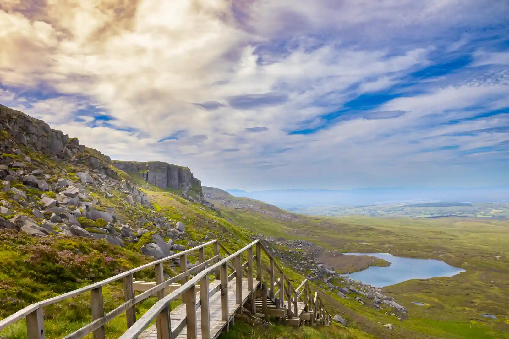
Cuilcagh and Upland Paths
Hill and boardwalk routes across blanket bog and limestone slopes around Cuilcagh Mountain.
Lough Erne Shore Routes
Low-level walking along lakeshores, islands, and causeways on flat or gently undulating ground.
Florencecourt Forest and Estate Paths
Woodland and riverside routes through managed forest and parkland with firm tracks.
Walking Character
- Interlinked lakes and islands
- Limestone hills and escarpments
- Wooded valleys and forest tracks
- Lakeshore and riverside paths
- Mostly gentle gradients
- Settlements focused on lough edges
- Predominantly inland and low-upland terrain